Sunday, June 9, 2019

Day 14-15


We started out day 14 of our trip in Guthrie, OK. The weather looked somewhat promising in the northwest corner of Kansas, but considering the storms weren't going to fire until late, it would have been too difficult to travel there and back since two of our cadets had 0500 flights the following morning in OKC. Instead of following the storms, we stayed put in Oklahoma City for the day and went to a small community pool. We met up as a team one final time that night for ice cream. Major Nixon had lost a previous bet to CDT Pengelley, and as a result, had to buy Pengelly's monstrous ice cream cone.

The following morning, we woke up to a flash flood warning and a heavy line of thunderstorms moving into the city.  The view outside the hotel room of the shelf cloud rolling in was incredible!  We made one last trek to the airport where we all went our separate ways.

All-in-all, this was a successful trip.  We got great information from the various bases we visited and were also able to observe numerous weather phenomenon including two tornadoes, gustnadoes, a developing haboob, supercells, hail, shelf clouds, etc.  Plus, criss-crossing the country, seeing the culture, and eating the local food was an unexpected bonus.  In all, we drove 5519 miles and visited five different states, missing New Mexico and Missouri by only a few miles.


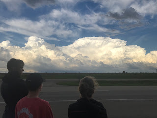
Approaching shelf cloud over Oklahoma City.  Not a bad view from the hotel room!

CDT Pengelly enjoys his ice cream, much to the chagrin of Maj. Nixon who had to pay.


Saturday, June 8, 2019

Day 13

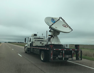
We started off the day in Temple, TX and drove to Norman, OK for a 1300 tour of the National Weather Center.  The National Weather Center is part of a sprawling complex that houses numerous research offices, and the building itself houses the Storm Prediction Center, the local National Weather Service Forecast Office, the National Severe Storms Laboratory, and the University of Oklahoma Meteorology Department.  Among other things, we went to an observation deck that overlooked the town of Norman and learned about the center’s plans for expansion.  Our tour guide also showed us vehicles used by NWS for severe weather research including radar trucks. We were also able to visit the Storm Prediction Center stationed inside the building and immediately noticed how few meteorologists there were in the center, especially considering they are responsible for issuing all severe weather watches across the entire country. The local NWS Forecast Office, who is responsible for weather forecasts and warnings for the city and surrounding counties, was slightly larger.  The tour of the Weather Center was led by a "real life meteorologist", who seemed to take great pride in his profession.  Maj. Nixon, also a "real life meteorologist", seemed unimpressed.   

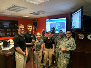
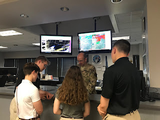
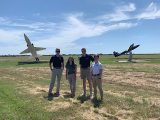
After the tour, we traveled to Tinker Air Force Base where we talked to their weather team. They explained daily operations and what they do in case of an emergency. They told us a few stories about the base’s interactions with tornadoes in the past, and also demonstrated how they transfer command when a shift is over. We ended the day in Guthrie, OK, just in case we decided to observe storms the next day, although the long drive and early flight times on Sunday make this unlikely.  

 In front of the National Weather Center in Norman, OK.

Movie props from the movie Twister.

Offices that house the Storm Prediction Center, the local National Weather Service Forecast Office, and the National Severe Storms Laboratory.

Cadets get a briefing from the Weather Team at Tinker AFB.

Tinker AFB.


Friday, June 7, 2019

Day 12

We started the day early in Lubbock, TX and began traveling southeast; the Storm Prediction Center had outlined an area of "enhanced" risk in south-central and south-east Texas.  The atmospheric conditions for southern Texas looked at least somewhat promising with unstable air, although upper-level support was lacking. We stopped in Junction, TX for a quick barbecue lunch, and shortly after lunch, storms started to fire as we approached the far northwest suburbs of San Antonio.  The topography here was quite different with large, rolling hills, numerous trees, and a winding road network.  Despite these limitations, we were able to watch a couple storms rapidly grow and eventually found a spot near Spring Branch, TX to observe the approaching thunderstorm. After watching the storm for a while, it was evident that it was not going to organize into a supercell.  As the storms began to form a line, we decided to call it a day in the mid-afternoon.  We hung out at a Starbucks (Maj. Nixon REALLY likes Starbucks) to let the storms pass before stopping in New Braunfels, TX to briefly visit friends of Dr. Kalkstein. Just above their house, we were able to observe some mammatus clouds under the anvil of the storm. We decided to stop for dinner and stay in Temple, TX, which would allow us a reasonable drive to make our tour of the Storm Prediction Center early tomorrow afternoon.
Approaching storm just south of Spring Branch, TX.

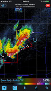
Radar image as we waited for the storm to pass.  Notice the distinctive shelf cloud radar signature at the bottom.  This line is the leading edge of the gust front and generally signifies the storm has become outflow dominant.

Big Country Pizza near Canyon Lake is perhaps the slowest pizza establishment in the country.  Sadly, we never did have an opportunity to sample their pizza.

 Mammatus clouds over New Braunfels, TX.  Thank you to Rob and Amy for hosting the cadets!

Lightning strike near Spring Branch.

Thursday, June 6, 2019

Day 11

We started our morning in Wichita, KS and decided to make the long drive towards the general vicinity of Amarillo, TX, despite the Storm Prediction Center's forecast of only "marginal" conditions.  Due to a general lack of wind shear, rotating supercells were relatively unlikely.  Initial storms began firing near Earth, TX, but they quickly fizzled.  We then targeted developing thunderstorms between Needmore and Enochs.  This cluster of storms quickly strengthened, and for a while, moved very slowly which allowed us to observe strong, hurricane-force winds affecting the landscape to our south. The strong winds were moving a tremendous amount of dust from the surrounding fields.  Once the cluster started moving more quickly to the east, we moved north and then east again to get out of its way and give us another nice opportunity to observe.  Multiple spin-ups of dust (gustnadoes) were occurring in a nearby field as part of the outflow, and further away, we saw evidence of dust being transported up into the storm through a possible landspout.  Eventually, the increasing outflow created a dramtaic haboob (dust storm) that we watched form, and shortly thereafter, called it a day.  We stayed in Lubbock for the evening, where we observed some pretty serious street flooding along with some reckless drivers and stalled cars.  Lubbock, TX was far enough southeast to hopefully set ourselves up to observe forecast storms in southern Texas the next day.
Time Lapse of a Severe Thunderstorm

Gustnado.
For all you Independence Day fans, “Welcome to Earth...Texas.”

Developing storm between Needmore and Enochs, TX.

Possible landspout near Needmore, TX.


The storm was kicking up a tremendous amount of dust with winds approaching hurricane force.  Radar-reported winds above the surface were well over hurricane force.

Tuesday, June 4, 2019

Day 9-10

On June 3, we started the day in Garden City, KS and decided to target the north, central part of the state.  Although it was a riskier target area (there was a strong stable layer in place just above the surface that would likely prevent storms from forming), the air above was highly unstable with modest wind shear.  This decision to head east was not the most promising from a storm perspective, but it put us in nice position to visit Fort Riley the following day.  In the end, no storms fired (which wasn't a surprise), and we spent the day in Junction City, KS. 

On June 4, we visited Fort Riley first thing in the morning. Their weather team was composed of mostly Airmen and a few civilians. They had a fairly large team, although many of its members were on deployment. They focused on protecting the bases' assets and personnel and also were responsible for briefing pilots on weather conditions before they took flight.  Although base contact with the local National Weather Service is somewhat limited, they do follow NWS discussion boards closely during severe weather.  After the visit, we decided to head further east, again hoping storms would be able to break through the stable layer and fire near the KS/MO border as a small shortwave trough moved through.  Again, nothing fired in the local area as any storm initiation stayed well to our east towards central and eastern Missouri.  With the forecast showing benign weather in the area, we made the decision to start a long drive further west towards the general area of the Texas Panhandle.  We'll be staying in Wichita for the night... 
Visiting Fort Riley.

Stopped for sushi in Topeka, KS...probably not the best idea, although so far, our stomachs are handling it alright.

Krispy Kreme just outside of Kansas City.

Monday, June 3, 2019

Day 8

We started our day in Amarillo, TX. At breakfast, we were trying to decide between two regions that had somewhat promising weather forecasts: southeastern Colorado and northern New Mexico. Colorado was closer to us, and we ultimately made the decision to head that way. We stopped at a local park in Lamar, Colorado and waited for the storms to start firing, but after about an hour and a half, we saw little development and decided to head south to Springfield, Colorado where at least a few modest storms were heading east. Here, we observed non-severe, multicellular clusters which had little organization and virtually no rotation.  It was interesting to see the importance of wind shear; without it, storms are unable to support sustained updrafts.  Once it started to get dark, we decided to spend the night in Garden City, Kansas to put us in better position the next day's storms.
Two Buttes mountain formation in SE Colorado.

Tossing the frisbee at Willow Creek Park in Lamar, CO.    
Clouds just in Springfield, CO.

Sunday, June 2, 2019

Day 7


We started day 7 of our trip in Guthrie, OK and were not terribly optimistic about our chances of severe weather observation due to a general lack of wind shear.  After a lengthy discussion, we decided to target the northern Texas Panhandle where we were hoping an outflow boundary from an old mesoscale convective system (MCS) would serve as an initiation point.  For much of the early afternoon, we were chasing ghosts as multicellular storm clusters would fire and quickly dissipate, as the shear was not sufficient to support sustained updrafts.  As the outflow boundary pushed south, we followed, and eventually, a couple supercells began to develop near Hollis, OK.  Although the first fizzled by the time we arrived, the second, southernmost storm was showing modest rotation and began bending to the right.  As we approached, it looked quite impressive.  With radar-indicated hail of over 2", we positioned ourselves southeast of the storm to watch.  After the rain subsided, we were able to collect some of the hail which was at least golf ball in size.  We decided to bail on the storm as it began to weaken, and thought our day was over as we headed towards our hotel in Amarillo, TX.  On the way to Amarillo, TX, we saw another beautiful supercell and fortunately arrived just before it crossed the interstate.  This storm lacked rotation, but was highly photogenic and put on quite the lightning show.  10 minutes after we passed, 2+" hail was reported on I-40.  Once we arrived in Amarillo, yet another severe-warned storm approached, and we observed an expansive shelf cloud, dime-sized hail, major street flooding, and some rather dramatic wind gusts.  We concluded the surprisingly eventful day with an enjoyable dinner at the Big Texan. 

Severe thunderstorm in Amarillo, TX.

Approaching supercell near Hollis, OK.


Golf ball sized hail.  Make note, this hail had been sitting out in rain for at least 3-5 minutes before we picked it up, so it was even larger when it fell.


Rainbow west of Hollis, OK.

Passing just ahead of a supercell on I-40, east of Amarillo, TX.  Ten minutes later, this storm dropped 2”+ hail on the highway.

Approaching shelf cloud in Amarillo.  We had been following this storm all day on radar since its initiation in NE New Mexico.  This storm brought us dime-sized hail, 60+mph winds, and bad street flooding.

Dinner at the Big Texan in Amarillo.  Notice the approaching storm in the background.

Saturday, June 1, 2019

Day 6

We started the day in Wichita Falls and headed north then west to make two stops to learn about severe weather preparedness: Fort Sill and Altus Air Force Base. There was a substantial difference in the level of involvement of each weather team in the operations of their base. Fort Sill had a small weather team, consisting of only two people. On the other hand, Altus Air Force Base had a much larger team and had more responsibilities due to the expensive aircraft on the base that could potentially be damaged by severe storms. In addition, more comprehensive forecasts are needed for the constant flight operations at Altus compared to ground-based artillery at Fort Sill.  After visiting the bases, we stopped for dinner in Oklahoma City and made our way to Guthrie, OK to be in a more advantageous spot for the next day's observations.
Cadets and Air Force weather NCOs at Altus AFB.  The spear was awarded to the weather flight for superior performance during the month of April.

Friday, May 31, 2019

Day 5

We started the day in Greenville, TX and since there was no severe weather forecast, we decided to visit the Sheppard Air Force Base in Wichita Falls, TX. At the base, we interviewed a senior NCO and the emergency management officer about their preparedness for severe weather, their training and education practices, and their communication with local weather centers. We learned that the base issues its own tornado warnings and watches, independent of the surrounding weather centers. In addition, they have a community outreach program for the base population. They also have agreements to lend local law enforcement, fire, and EMS their assets in the case of an emergency.

Cadets discuss severe weather preparedness with the weather flight NCOIC.

Cadets hear from the base emergency management officer about how Sheppard AFB handles emergency situations both on the base and also within the local community.  Can you spot Al Roker?

Sheppard Air Force Base

Thursday, May 30, 2019

Day 4


We started off our day in Salina, KS and were faced with the decision to either start visiting Army/Air Force base and drive less...or travel all the way down to storms that were forecast to fire in northeast Texas. The storms ultimately looked promising, so we got back on the road.  We were targeting an area northeast of Dallas and took a more eastern route to try and stay ahead of massive amounts of rain.  Unfortunately, it started raining near Oklahoma City, and it rained...and rained...and rained.  In Bogata, TX, we finally emerged from the downpours and were treated to a well-organized mesocyclone.  Much to our surprise, this storm had beautiful structure and a distinct, rotating wall cloud yet no warnings had been issued.  We followed this storm east for a little while before it began weakening.  Throughout the day, we saw three additional storms, each with picturesque, low-hanging mesocyclones.  Still, we seemed to be a step behind most of the day, as each of these storms was generally weakening by the time we arrived.  We eventually decided to call it a day and stay in Greenville, TX.  On our way (four miles west of Winnsboro, TX), we saw impressive tornado damage that had occurred earlier in the day.  Numerous, large trees had been snapped in half, and sheds and other structures not securely grounded were largely destroyed.  Fortunately, the homes themselves seemed relatively unscathed, but seeing such large trees entirely destroyed was a stark reminder of how powerful these storms can be.


Dr. Kalkstein gives a quick lesson on stability on the way to our target in northeast Texas.
Surprisingly well-organized supercell near Bogata, TX.  This storm was not severe-warned despite a clear, rotating wall cloud and some beautiful structure.
One of the four mesocyclones we observed for the day.


Our position just south of a tornado-warned, but weakening supercell near Pittsburg, TX.

Wednesday, May 29, 2019

Day 3

We started off the day in Goodland, KS, and the Storm Prediction Center had highlighted an area of "moderate risk" (the fourth highest of five categories for severe weather) stretching from far eastern Kansas into northern Missouri.  Ultimately, we decided that area was too far for us and also had less desirable terrain so we decided to target north, central Kansas instead, where an approaching warm front would hopefully trigger some late afternoon storms.  We headed east to Salina, KS where we stopped to reevaluate our position while eating some fantastic BBQ at Hickory Hut. We then drove north to Concordia, where we waited patiently for storms to develop while talking to other weather enthusiasts.  Storms finally fired late in the afternoon, and we drove west where two supercells were rapidly strengthening.  West of Concordia, we stopped on a hill and waited as the first of the two storms approached.  The wind was howling, and the skies grew increasingly ominous.  Although a confirmed tornado was reported several miles from our location, it was obscured by rain.  We then pushed back east to get into better position as the second storm approached.  By the time it reached us, this supercell had weakened somewhat, but it still produced some spectacular skies.  We eventually called it a day, and as we drove back toward Salina, we were able to see massive supercells to our east.

Passing one of NOAA’s mobile radar units on the way to our target area in Concordia, KS.

Radar image highlighting our position (blue circle) west of Concordia.  The tornado-warned storm passed several miles to our west with a confirmed tornado, although it was obscured by rain so we couldn’t see it.

Great BBQ lunch stop in Salina, KS.

Hickory Hut is a popular spot among weather enthusiasts!

Severe thunderstorm near Jamestown, KS.

Incredible line of supercells to our east as we drove south from Concordia to Salina. The lighting was spectacular.

Cadets admire the supercells.
A beautiful sunset marked the end of an exciting day.

Tuesday, May 28, 2019

Day 2

We started out the second day of the trip in Wichita, KS. Early in the morning, models indicated an enhanced risk of severe weather across southeast Wyoming, but that was far away from us, so we debated whether to head out or stay in Wichita to wait for storms the following day. We decided to travel northwest, cutting through Nebraska and ending up in noutheastern Colorado, about a 6 1/2 hr drive.

We stopped in a small town called Holyoke, Colorado to figure out which storm we should follow. The main storm in the area was a large supercell about an hour to our northwest.  Several tornadoes were confirmed with that storm, but it was pulling away from us to the north.

Cadets throwing a football under a tornado siren in Holyoke, Colorado, waiting for storms to develop.
There was a second cell that developed about 30 miles southwest of Holyoke.  Although it wasn't as impressive as the main supercell, this storm did show signs of rotation at around 11,000 ft.  We decided to get a closer look at this storm, traveling down country roads south of Paoli, Colorado. Once we drove past the precipitation shield, we were able to sit and watch the rotation become more clearly defined over about 20 minutes time.  As the storm intensified, we clearly saw the rotation of the storm and scud clouds being sucked up into the developing wall cloud.


Watching a developing supercell south of Paoli, CO.  At the time, we were the only ones on this storm thanks to Maj Nixon's prophetic forecasting.
Throughout our observation, the structure of the storm was very clear, as we could see the wall cloud and the mesocyclone. Right before the first tornado, the team noticed an increase in temperature of the wind blowing into the storm. After the temperature change, the storm gained intensity rapidly and even shifted directions.  We saw at least 4 small, brief tornadoes emerge. Each tornado lasted only a couple minutes at most.

Cadets in front of a possible tornado south of Paoli, CO.  Notice the dust under the rotating wall cloud.

Brief tornado touchdown.  Swirling dust and dirt on the ground under the rotating wall cloud.

In front of a supercell shortly after we observed a multi-vortex tornado that was on the ground 1-2 minutes.

Viewing the supercell as it travels away from our location and towards Holyoke, CO. 

Clear view of the rotating mesocyclone in a supercell near Holyoke, CO.
After observing the initial storm, there was another developing supercell outside of Wray, CO. Our view was largely blocked by precipitation during this storm, but there was a very clear Beaver's tail, which is a type of inflow band into the storm. We also saw a distinct mesocyclone form.

Watching a supercell pulling north of Wray, CO.

Beaver tail cloud formation indicating the inflow to the mesocyclone near Wray, CO.

Beautiful structure of a supercell between Wray, CO and Paoli, CO.